/
-
Dynon SkyView system provides an integrated flight deck solution with two screens and a multitude of connected sensors units that provides full flight, engine and navigation information as well as integrated autopilot functionality, all with a comfortable interface to a number of other systems.
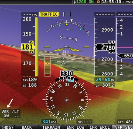
SkyView displays can act as Primary Flight Display (PFD) with Synthetic Vision, an Engine Monitoring System (EMS), and a Moving Map in a variety of customizable screen layouts. SkyView’s PFD display enhances situational awareness with realistic and accurate 3D depictions of runways, obstacles, terrain, and water.
SkyView’s “six-pack” mode bridges retro analog gauges with the state-of-the-art. This mode is good for the pilots who are new to glass and like analogue instruments. -
All flight information is provided to SkyView by two independent Air Data and Heading Reference System (ADAHRS) units. Individual sensors within the ADAHRS units provide air and flight data information for display on the SkyView screens. In normal operation the system utilizes ADAHRS data of the selected primary ADAHRS. In case of a ADAHRS failure the units switch to the second ADAHRS as data source. This also can be triggered manually. -
SkyView contains the tools you need to completely manage your power plant. One EMS module provides all engine information via different sensors, including the industry’s only automatic exhaust gas temperature lean/rich mixture detection that requires no pilot action and the most accurate percent power calculations possible.
All installed components are connected by network and share the data. In the case of a display failure in anyone of the units, the data from the unit can be shown on the remailning functioning display. -
Both displays are powered by backup batteries. The backup batteries will allow to run the screens and the most relevant sensors units to perform safe completion of the flight.
SkyView’s free worldwide terrain data is the highest resolution available. Terrain colors are designed to look similar to charts while you’re on route. They alert in vibrant yellow and red when altitude clearance is a factor. -
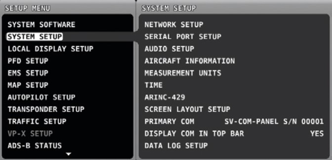
You shouldn’t have to be a computer programmer to install your avionics: an intuitive, hierarchical setup menu helps you configure your system with ease. -
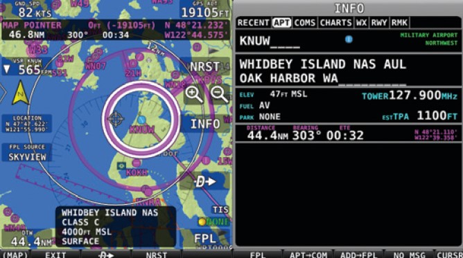
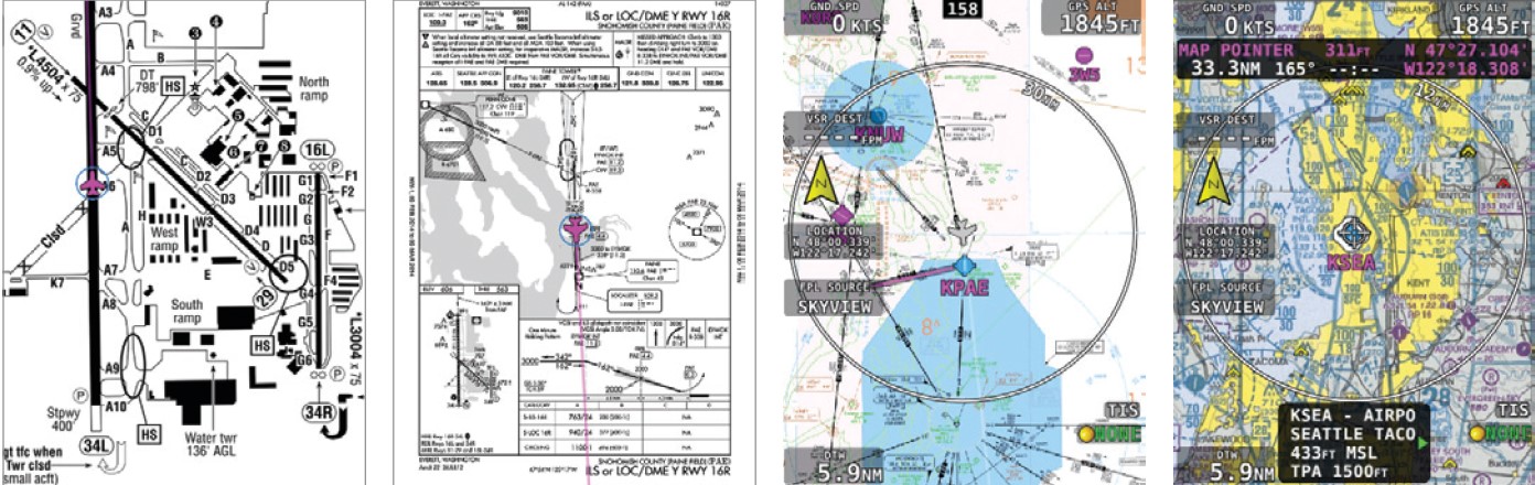
Point at airports, airspaces and more for instant information about them right on the map. From there, one button press gets you virtually all the information available for airports, including traffic pattern altitude, frequencies, services, charts, weather, and even the airport facility directory remarks. -
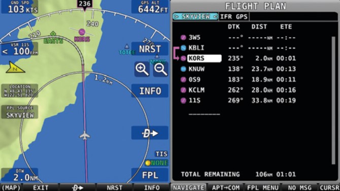
SkyView’s navigation engine flies like you would. It anticipates waypoints and turns just before them to avoid needless overshoots. You can even display the graphics and waypoints from external IFR GPS flight plans. -
With procedure charts (plates), airport diagrams, IFR en route charts, VFR sectionals. And SkyView’s own map, you can truly achieve a paperless cockpit at the lowest prices in the industry. -
Predictive terrain alerts dynamically shade terrain in yellow or red, based on the aircraft’s projected flight path. -
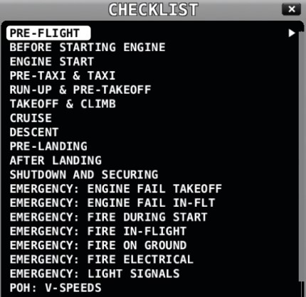
Checklists help remove paper clutter from the aircraft. Add as many checklists as you like – they’re easily created and edited on any computer. -
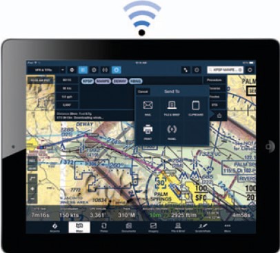
Plan your flight at home using your favorite planning application, then save time at the airplane by sending the planned route to your SkyView system via the Wi-Fi adapter.